Innovation takes many forms in Colorado.
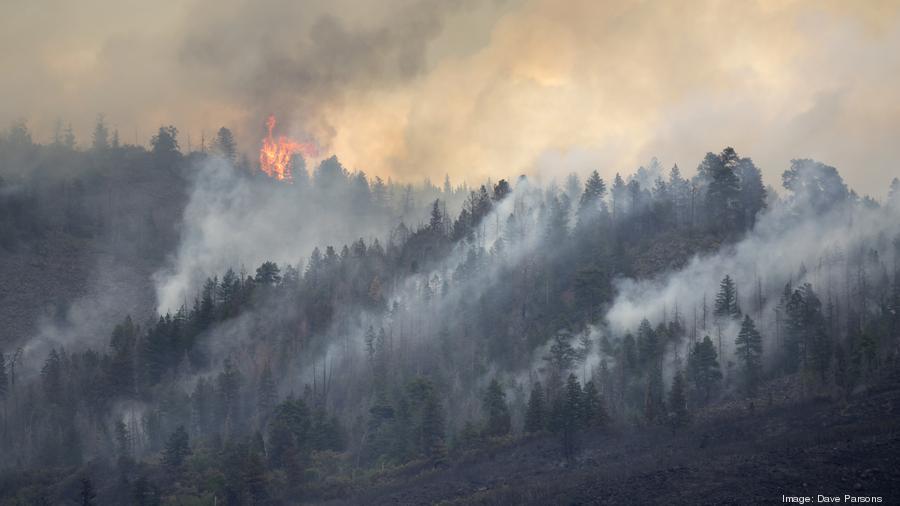
As wildfires consume thousands of acres every year, the state is constantly looking for a technological edge to stay ahead. That’s where the Colorado Division of Fire Prevention and Control’s Center of Excellence comes in.
The organization is committed to researching, testing, and evaluating existing and new technologies to fight wildfires.
Ben Miller, director at the Center of Excellence, said the group realizes the importance of staying connected with the latest technology.
“It’s important that we’re looking at tech, because it’s not slowing down. If we’re not on top of things, it would be bad to know there’s technology out there to do our job, and we didn’t know about it,” he said.
This year, the Center of Excellence debuted the Android Team Awareness Kit (ATAK), a geospatial mapping engine that facilitates situational awareness, navigation and data sharing among firefighters.
As most fires occur miles away from reliable internet access, ATAK provides emergency personnel with smartphones and antennas to create a mesh network.
This allows firefighters to access a common map that displays areas of interest, like the location of the trucks, pump and hose supplies that had been dropped off by another crew, and the crew lookout.
“Firefighters can share maps. They can put an icon that says we’re going to have lunch here,” Miller said.
In an expanded use of ATAK, Miller said the Center of Excellence has integrated the technology with drone cameras to share birds-eye view data with firefighters on the ground. The drone operator can relay information to firefighters, and they can review the drone’s positioning using ATAK.
Miller said both pieces of technology were vital this year and will be used in future wildfire seasons.
“It’s building out the tactical infrastructure piece,” he said. “This is a simple way to share info without having big bandwidths to share.”
Future Technology
In the future, Miller said the Center of Excellence will test a system that can predict the spread of fires. The technology will bring in past fire and weather data to determine a fire’s path.
This will allow firefighters to prioritize mitigation based on expected damage if the fire were to continue on its route.
“A given jurisdiction may only have resources to chase three of these many fires. So, this tells them which ones to prioritize,” he said.
Miller said the organization will also look at drone delivery and unmanned ground vehicles as modes of resource transportation.
As technology evolves, so will firefighting techniques. Miller said the Center of Excellence is constantly monitoring the innovation ecosystem to stay as far ahead as they can.
“We’re fully committed to making sure if we can do it better, we’re going to,” he said.
Geospiza
One Colorado startup has also looked into combating wildfires, taking an alternative approach using data to identify risk areas before disaster strikes.
Sarah Tuneberg is an emergency manager by training, with a focus on using technology to better meet the needs of underrepresented sections of the population.
While working as an emergency management consultant, Tuneberg developed a program that would pull from a host of data sources to identify who and what was most at risk during a natural disaster. She eventually took that program and launched Geospiza, getting into the 2018 Techstars Boulder class.
Geospiza is a software platform that aids emergency managers, elected officials and corporate leaders in making data-driven solutions that reduce risk. The platform pulls from datasets like census, weather, traffic, building code, Medicaid and others to develop an emergency management plan.
Before disaster strikes, Geospiza will identify which people, homes and neighborhoods are most at risk.
In testing Geospiza, Tuneberg said the team analyzed the 2017 Northern California wildfires. The average age of people who died was 65, and a high number of them were elderly, either disabled or bedbound, Tuneberg said. Geospiza was also able to see that cell phone connection in that area was limited, meaning amber alert style warnings wouldn’t land with that population.
“There were people who can’t evacuate without assistance, can’t hear, and don’t have cell service,” Tuneberg said. “So, that means knocking on doors or sending more staff.”
In addition to gathering data on at-risk individuals. Geospiza can also analyze building records to determine which houses and buildings are at highest risk during fires.
“We have a tool that you can using parcel level data and construction data, and data from permits can know what houses are likely to burn from embers,” Tuneberg said.
The technology gives municipal bodies and emergency management organizations the power to be proactive, rather than reactive, in protecting against disaster.
“If we can reduce and mitigate the risk, we save a ton of money not to mention saving lives and emotional trauma. The cascading, compounding benefits of mitigation are so huge,” Tuneberg said.
Tuneberg said Geospiza is in talks with Colorado municipalities and government organizations to integrate Geospiza into its emergency management.